Goldfields Trip

Western Fwy then north up the Ballan-Daylesford to Daylesford, north to Mt Franklin, west through Yandoit, then past Mt Kooroocheang and Mt Moorookyle, and then back to western Hwy via Creswick.
9 April 2012 (afternoon)
Weather: cold and showery with sunny breaks
The first new volcano we saw was Bald Hill well to the east of the road, but this looks better approached from the Blakeville Rd and we left this for another day. Closer, and on the west side of the road 3-5km north of Dehnerts Rd corner was Mt Cleaver. We got as close as we could to this fairly old looking lava hill using a side road, before going back to the main road to head further north. Guided by DPI's EP list and what we could see in terrain view, we were on the look out for three 'lava hills' really close to each other on the right just before the junction at Leonards Hill. These are in order, from the south, Beavers Hill, Kellys Hill and Leonards Hill. We got glimpses of the first two of these, although appreciating the landscape was difficult because of the forest. On the other hand this did mean that they were on public land and we could possibly get quite close if we found a good way through the rough forest roads. However, we didn't have much luck. Approaching from the north might be worth a try on another day.
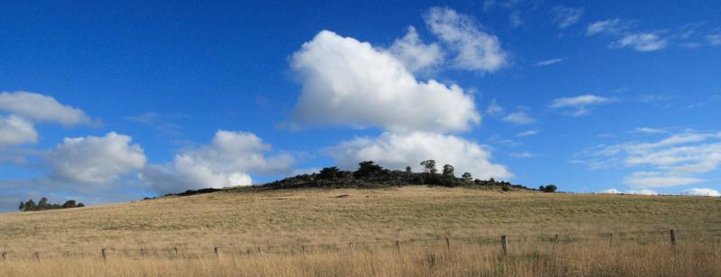
We got ourselves back to the main road and heading north, we got a much better view of Leonards Hill , made all the more obvious by it being cleared and the two large wind turbines on top of it. We then headed north to Daylesford stopping to admire Sailors Falls and the exposed lava there. After lunch in Vincent St, we drove up the scoria cone in the middle of town (Wombat Hill) passing same excellent exposed scoria layers in the road cutting. The cone is covered with exotic forest (Botanic gardens) growing out of the obviously red soil but we couldn't really see a crater. Climbing the lookout tower on top gave us a view of many of the volcanoes we would be visiting that afternoon.
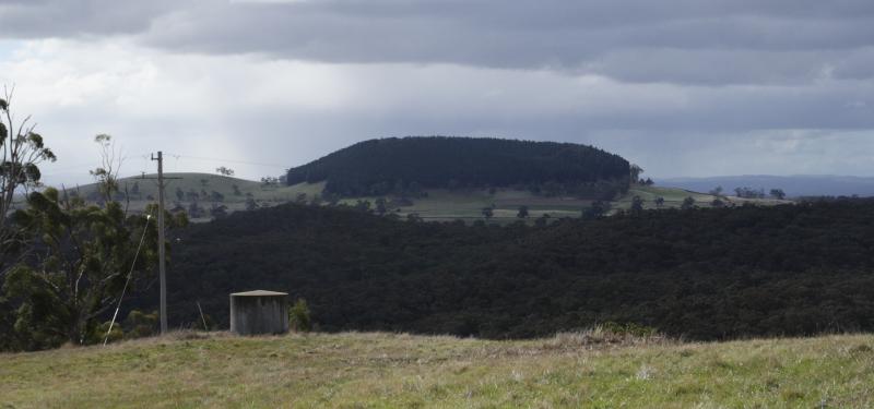
We got on the Midland highway North of Daylesford and shortly aftwards on the Eastern side of the road was Fern Hill on open ground. It looked like a complex eruption point, with multiple craters. Lava flows were not evident, but we drove past pretty quick, so more investigation is warranted.
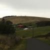
A few kilometres North, we turned left down Bunnings Road up on to an old scoria cone. Whilst an interesting feature in and of itself, there was a great view to the North of Mt Franklin. The transition from scoria and igneous rocks was quite evident as we headed back to the Midland Hwy.
Mt Franklin is a younger looking feature, quite striking, with a steep sides breached cone which you can drive right into. There is a camping ground inside and a dirt track up around the cone. The thick cover of exotic vegetation spoiled the experience for us, as it was hard to see the volcanic features clearly. The pine forest planted on the outside slopes of the crater also prevented us from properly appreciating the views from here.
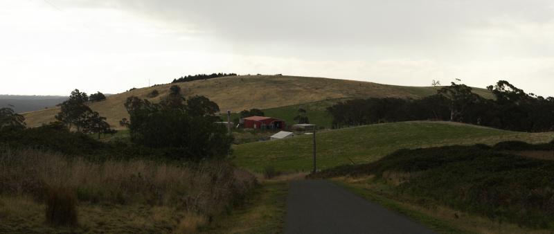
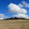
As we left Mt Franklin we noted the parasitic eruption point named Lady Franklin just adjacent to the west. A little further north, on the junction of the Midland Hwy and Daylesford-Newstead Rd is another feature named Mt Stewart, another scoria hill. It seemed quite eroded and older than Mt Franklin.
Heading west we drove through the older part of Yandoit, taking many pictures of the old stone buildings. This is quite confusing country side, as we could clearly identify the old eruption point of Yandoit Hill, but only just from the lava capped hills surrounding it. There were also flows down into the valleys, confusing things even further. The only explanation we can come up with was that it is an old feature, with a lot of sedimentary rocks eroded from around lava flows.
From there, we headed West then South along Werona-Kingstone Rd, past Heaghney Hill (lava hill), with quite pronounced rocky outcrops on the top and annoyingly a house plonked on top. From there, we past two more unnamed eruption points near Werona.
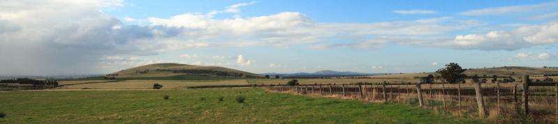
Traveling West we headed out into the plains where the massive Mt Kooroocheang was looming. This is a magnificent mountain with an access road visible from the Ullina-Kooroocheang Rd. Imagine our disappointment when we discovered a strongly worded keep out sign from Aviation Australia preventing us from having a nice walk up the kill. If ever there was a mountain that should be open to the public, to allow them to appreciate from a height the magnificence of the closely packed volcanoes of the Clunes district, surely this is it.
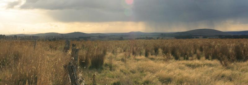
Whilst stopping to take photos of Mt Kooroocheang, there were some great views to the north of Mt Powlett, with a visible crater, and Stewart Hill more to the West. It was also very nice to see showers passing over the cones to the north.
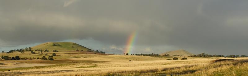
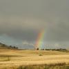
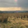
The sky was blackening to the south and temperatures where dropping and it was getting late, but we had at least one more volcano in our sights before heading home: Mt Moorookyle. This beautifully shaped, heavily eroded hill would once have been a magnificent sight and it didn't look too bad on this day. We had the sun at our backs and a shower coming up from the south over the peak, giving us an incredibly strong rainbow framing the volcano that had to photographed, and we lost about half an our taking shots. Even Tegan got out of the car into the cold wind and took photos with her phone.
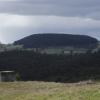
We decided at this point to head home, but couldn't resist trying to get close to Clover Hill which is just off Daylesford-Clunes Rd. We stopped one more time to take photos of this hill and Moorookyle, before heading south where Woodhouse Hill was on the horizon. Further south and more distant was Birch Hill, which we put on the list of eruption points to see another day.
Finally we past another unnamed eruption point to the left. This area is also chocka-block full of gold mines, both old and new, which adds to the distinctiveness of the area. We can't help but think that the prevalence of gold in this area is directly attributable to the plethora of eruption points on the plain.
We loved touring this landscape, with it's high density of volcanoes popping out of the sweeping plains and we are looking forward to returning to give it the time it deserves.